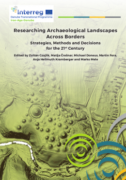
Researching Archaeological Landscapes Across Borders

Researching Archaeological Landscapes Across Borders
| 0 Ft |
| Price |
Researching Archaeological Landscapes Across Borders. Strategies, Methods and Decisions for the 21st Century
Project: Iron-Age-Danube
Budapest, Archaeolingua, 2019
Puhakötés | Paper book
186 oldal, színes és fekete-fehér illusztrációkkal | 186 pages with colored and grayscale images
ISBN 978-615-5766-27-5
The book is available as pdf on the project’s website.
If you would like a printed copy, please contact us at info@archaeolingua.hu.
Description
Archaeology with its methodology is currently undergoing massive changes. While until recently, “archaeology” generally had the connotation of “digging” and the making of individual precious archaeological finds, non-invasive research methods are gaining more and more importance and have begun to challenge archaeological excavations as the primary archaeological information source. Moreover, today’s widespread use of large-scale archaeological prospection has shifted the focus from single sites and finds to a more comprehensive approach into the research of cultural landscapes.
The shift of the research focus was reinforced by an accelerated development of new and enhanced technologies, such as airborne laser scanning (ALS) or advanced and motorized archaeological geophysics. Technological development is being accompanied by new methodological approaches in (archaeological) landscape research, theoretical approaches in understanding cultural landscapes, as well as adaption of legislative frameworks for monument protection on various levels and the establishment of preventive archaeology.
The changing archaeological research landscape makes it necessary to rethink our approaches towards landscape research. This is true to an even greater extent, as the European Cultural Heritage Strategy for the 21st Century (Strategy 21) will require us to widen our future archaeological project applications towards an assessment of their social, economic, territorial and educational impacts.
This publication is attempting a first step in the direction of a comprehensive examination of the changing world of archaeological methodology. It is an attempt by the international partnership of the Iron Age Danube Project involving professionals from Austria, Croatia, Hungary, Slovakia and Slovenia to create an easy-to-read guidebook for a comprehensive approach to archaeological landscape research in the light of Strategy 21. Its concept is not to produce yet another methodological manual for archaeologists already working in landscape research. It should be seen rather as a guidebook, a methodological tool for cultural heritage managers involved with the archaeological heritage and also for the new generation of upcoming archaeologists facing their first challenges in the research and preservation of the archaeological heritage. In this respect, the publication connects practical guidelines for the use of state-of-the-art research methods with theoretical and legislative necessities at the European level.
Table of contents
I.1 Foreword – purpose of the tool. Marko Mele
I.2 Landscape as an archaeological heritage. Dimitrij Mlekuž
I.3 European Heritage Strategy for the 21st Century – Strategy 21. Jelka Pirkovič
I.4 From Strategy 21 to archaeological methods. Marko Mele, Martin Fera
I.4a Consideration 1 – “Scale” of the research project. Marko Mele
I.4b Consideration 2 – “Goals” with respect to the components S – D – K of Strategy 21. Marko Mele
I.4c Consideration 3 – “Methods” for the landscape research. Martin Fera
II.1 Introduction. Martin Fera
II.2 Baseline-Assessment. Zoltán Czajlik
II.2a Costs, time, accessibility
II.2b The environmental context
II.3 Practical considerations and legal framework. Martina Jurišić, Susanne Tiefengraber, Katalin Wollák, Katharina Zanier, Matija Črešnar, Martin Fera
II.3.1 General Introduction
II.3.2 Permits for archaeological research
II.3.2a General requirements
II.3.2b Special requirements for remote sensing and geophysics
II.3.3 Research in protected natural landscape areas, ecological network Natura 2000 and forested areas
II.3.4 National sources of data for permits and approvals and other useful data
II.3.5 International sources of data
II.3.6 International sources of geodata
II.4 Methods
II.4.1 Desktop assessment
II.4.1.1 Investigation of archaeological sites using old maps. András Bödőcs, László Rupnik
II.4.1.2 Archival and cartographic aerial photographs, satellite images. András Bödőcs, László Rupnik, Michael Doneus
II.4.2 Archaeological surface survey. Luka Gruškovnjak, Susanne Tiefengraber, Matija Črešnar
II.4.3 Surveys with soil analysis and archaeological soil chemistry. Roderick B. Salisbury
II.4.3.1 Geochemical mapping in hillfort studies. Branko Mušič, Nina Zupančič, Matija Črešnar,
Matej Dolenec, Igor Medarić, Barbara Horn
II.4.4 Archaeological geophysics
II.4.4.1 Introduction. Branko Mušič, Barbara Horn
II.4.4.2 The basics of magnetometer measurements. Igor Medarić, Sándor Puszta, Zoltán Czajlik, Branko Mušič
II.4.4.3 The basics of low-frequency EM geophysical measurements. Petra Basar, Barbara Horn, Branko Mušič
II.4.4.4 The basics of Electrical Resistivity Tomography (ERT). Barbara Horn, Branko Mušič
II.4.4.5 The basics of resistivity mapping (twin probe array). Barbara Horn, Branko Mušič
II.4.4.6 The basics of ground penetrating radar measurements. Branko Mušič
II.4.5 Remote sensing data collection methods
II.4.5.1 Aerial archaeological photography. Zoltán Czajlik, Michael Doneus
II.4.5.2 Airborne laser scanning. Michael Doneus, Martin Fera
II.4.6 Archaeological excavations. Martin Fera
II.4.7 Modern methods and approaches in archaeobotany. Andrej Paušič, Ignac Janžekovič, Janja Kotnik, Andrej Šušek
III.1 Summary, conclusion and outlook. Marko Mele, Michael Doneus, Martin Fera, Matija Črešnar
IV.1 Glossary and dictionary (eng-deu-hrv-hun-slv)
IV.2 Literature
| |
|
|
1067 Budapest, Teréz krt. 13. |
|
|
|
|
About us
The Archaeolingua Foundation and Publisher is involved in publishing series and standalone publications in the disciplines of archaeology, linguistics, historic sciences and heritage protection for over 25 years.
Learn more
Publishing
We publish both as standalone editions and as a volume of a professional series.
Learn more
Contact us
Archaeolingua Foundation

